On 23 November I was able to track a radiosonde launched by the National Weather Service office in Birmingham AL all the way to landing. I tracked it from the Garden’s Overlook in FDR State Park using the equipment listed in this article.
Acquisition of signal was at 11/23 23:41:59 UTC at an altitude of 8923 m (29,275 ft) and a distance of 168.3 km (104.6 miles). The maximum altitude I recorded was 32,688 m (107,244 ft) near Milltown AL followed by a 34 second loss of signal. After reacquiring the signal the radiosonde was descending so I do not know the exact burst altitude. The descent time after reacquiring the signal was 59 minutes 10 seconds.
click images to enlarge

Tracking with SDR#, Sonde, and SondeMonitor near the burst altitude
The final GPS fix was received at 11/24 01:59:09 UTC. The location (32.863560, -85.031898) was the Oakhurst Farm Weddings & Corporate Events center near Jones Crossroads in northwestern Harris County. The altitude in that final GPS fix was 219.5 m (720 ft). The Google Earth elevation data for that location is 753 feet. This, coupled with the fact that I was still receiving a weak signal at 02:05 UTC, indicated to me that the radiosonde had landed close to the final GPS fix and was possibly on the ground instead of in a tree.
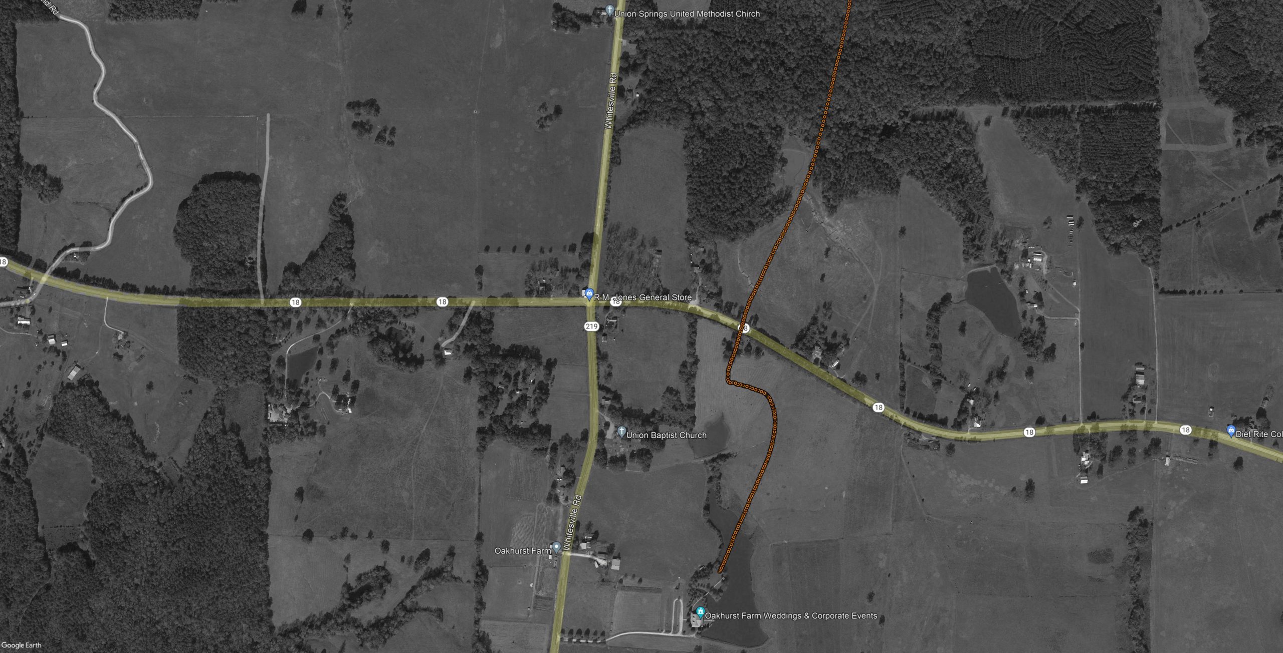
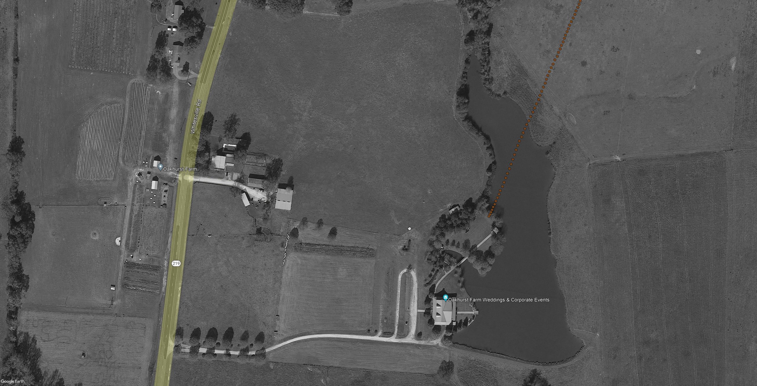
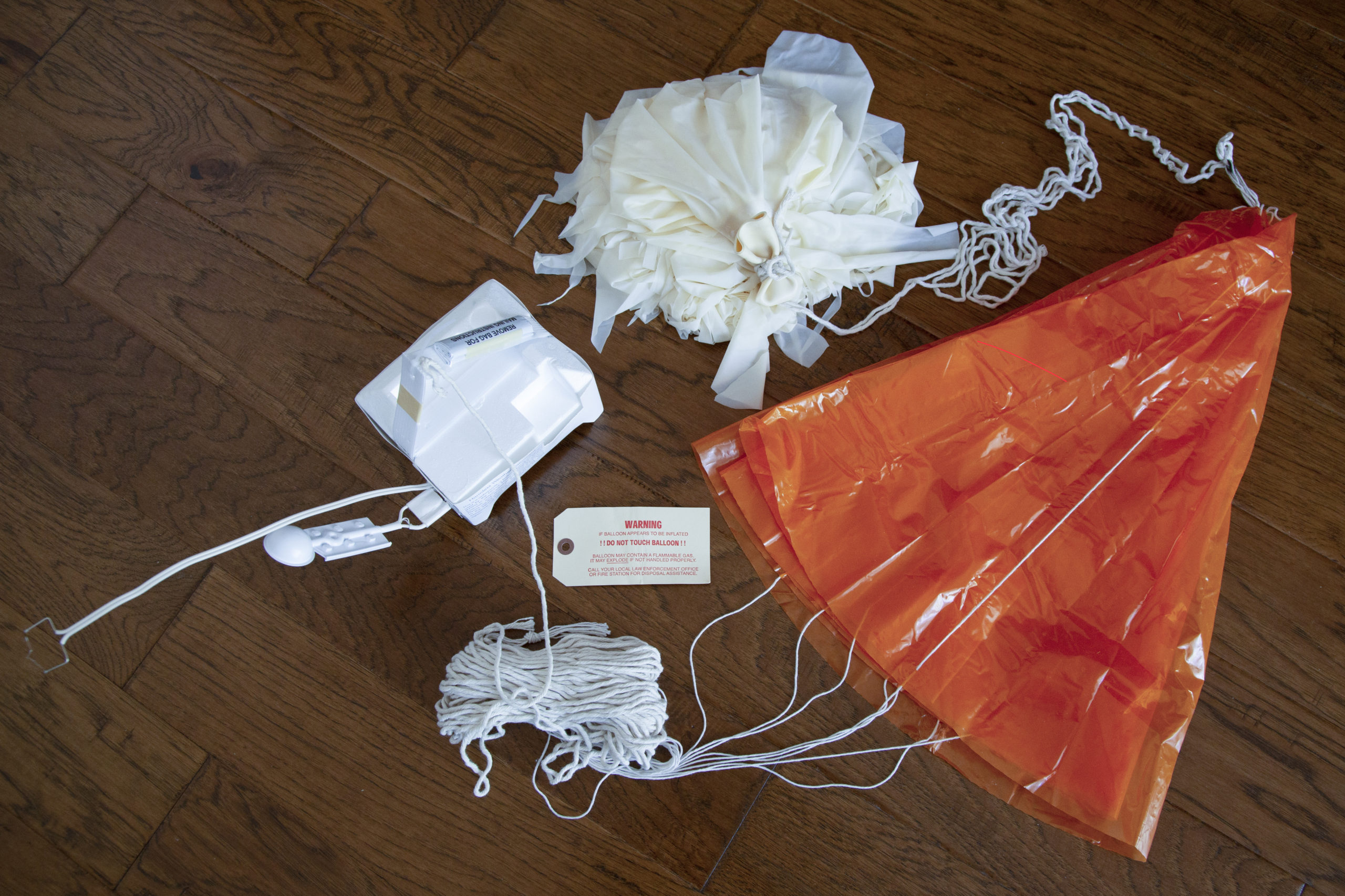
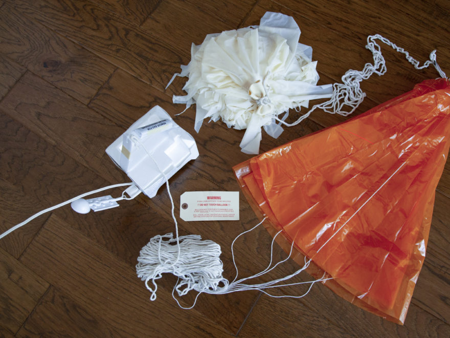
I called Oakhurst Farms the next morning and they were able to verify the radiosonde and parachute were on the ground. I was given permission to retrieve the radiosonde and upon arriving on site I found the landing location was within 15 feet of the final GPS fix.

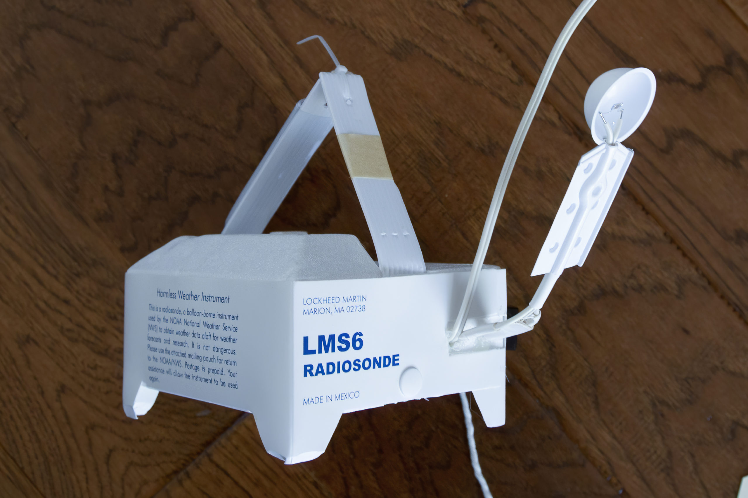
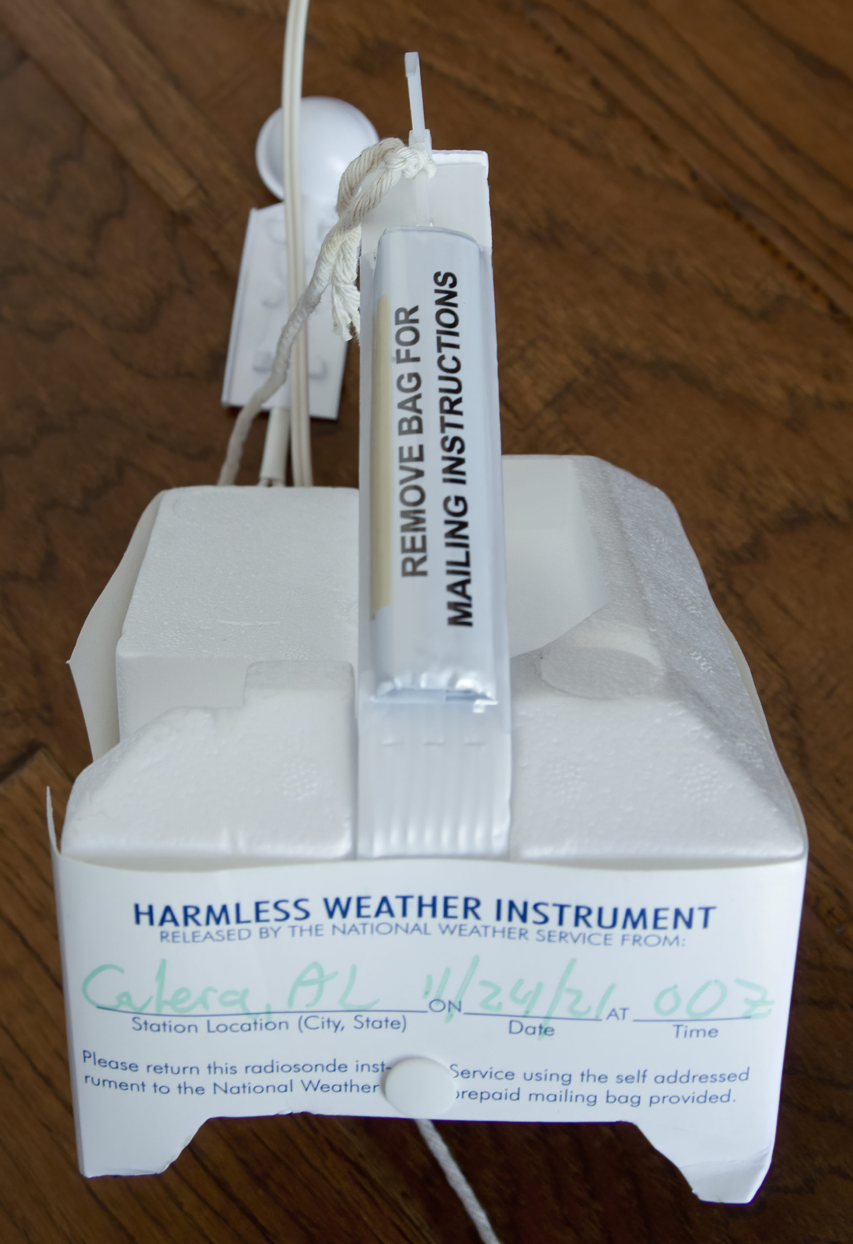
The radiosonde was in good shape and was returned to the NWS using the mailing envelope attached to the radiosonde.