Harris County, Georgia is probably the last place you would think of when trying to view a rocket launch from Cape Canaveral. But thanks to its geography, and given the right conditions, you can easily see a launch with spectacular effects.
Which Launches Can Be Seen?
All launches from Kennedy Space Center or Cape Canaveral Space Force Station can be seen from Harris County. The map below shows the four main launch corridors:
- These are primarily crewed and commercial resupply missions to the International Space Station. These provide the best viewing opportunity, reaching up to 15° above the horizon.
- These are launches to geosynchronous and geostationary orbits along with lunar and interplanetary missions. These can reach up to 10° above the horizon.
- The latest Starlink satellite missions have been using this corridor. They only reach 5° above the horizon.
- Any launch requiring a polar orbit will use this corridor. These can reach up to 10° above the horizon.
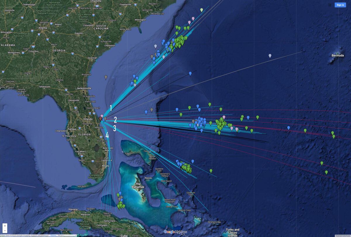
The corridor being used can be found in the Launch Hazard Area advisory posted on the Space Launch Delta 45 website prior to every launch.
Viewing Locations
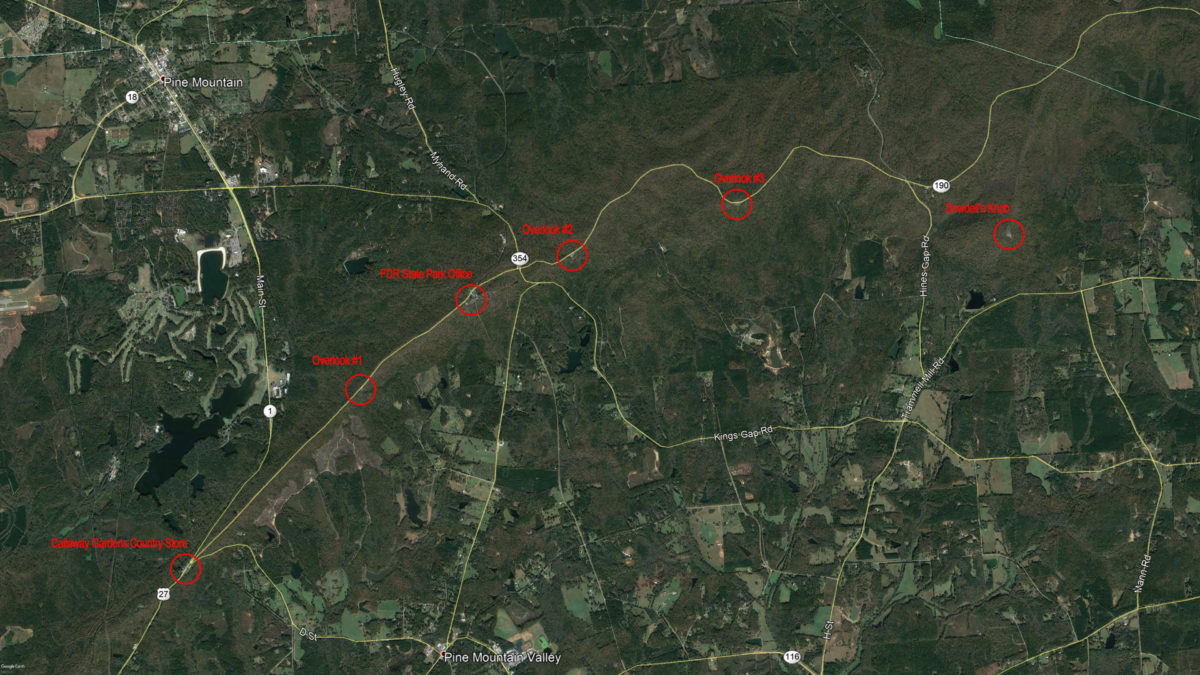
Any place with a clear view of the eastern horizon will allow you to see some portion of a launch. An elevated view is preferred since the rocket will never climb higher than 15° above the horizon (the width of your fist held at arm’s length is about 10°). Luckily Harris County is home to the Pine Mountain Ridge, the southernmost mountainous region in the eastern United States. This 1300-foot tall landform provides several elevated viewing locations.
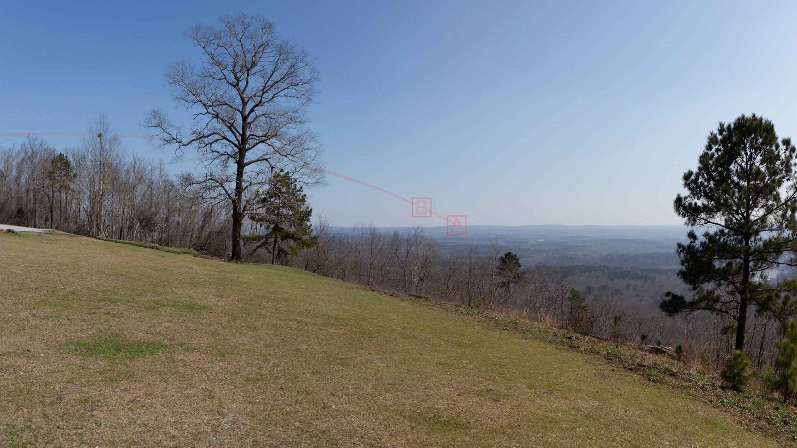
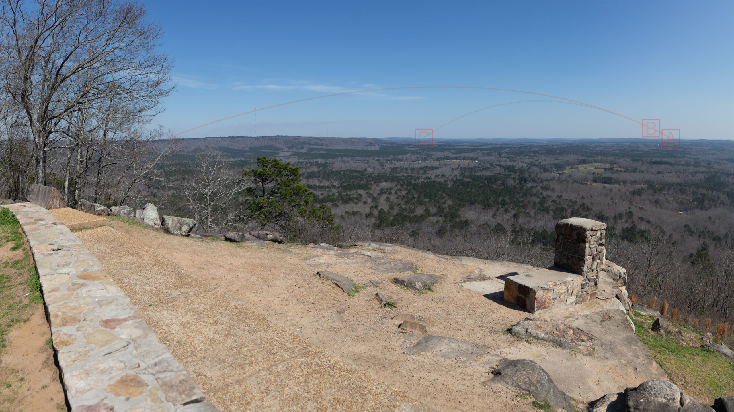
Each location below shows the sight lines for launches to the International Space Station.
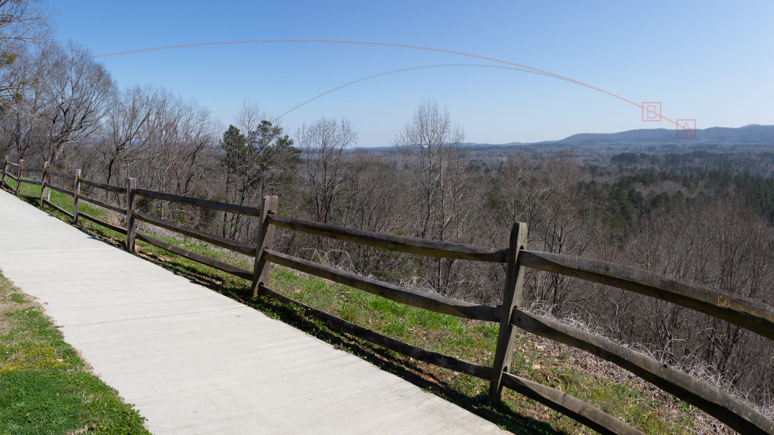
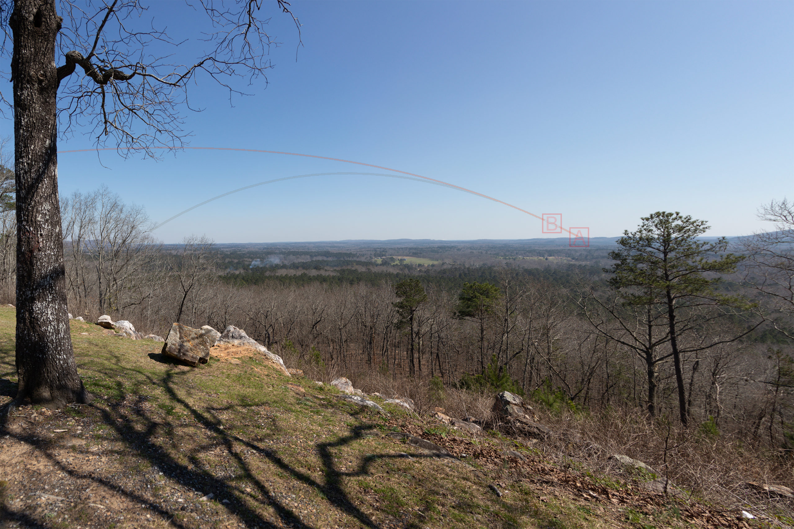
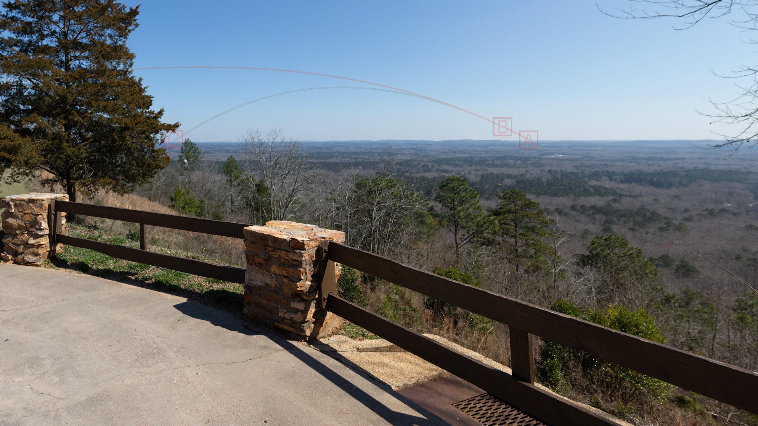
A is where the rocket will appear on the horizon and where the booster entry burn will occur for missions that return to Cape Canaveral. Other missions will appear on the horizon close to A as well. Typically this is on a compass heading of 135° to 137°.
B is where stage separation occurs. Stage separation for Atlas and Delta rockets will occur higher above the horizon.
C is where the booster entry burn occurs for a drone ship landing. Typically this is on a compass heading of 90° to 100°. The only locations where this is visible in FDR State Park are the Park Office and Dowdell’s Knob.
Callaway Gardens Country Store (32° 48′ 36.9″ N, 84° 51′ 22″ W)
Across from the store is an overlook of the Pine Mountain valley. The west end of the fence line provides the best view.
Overlook #1 (32° 49′ 43.4″ N, 84° 49′ 51.7″ W)
This is the first southern facing overlook you encounter when traveling east on Hwy 190 from the Callaway Gardens Country Store.
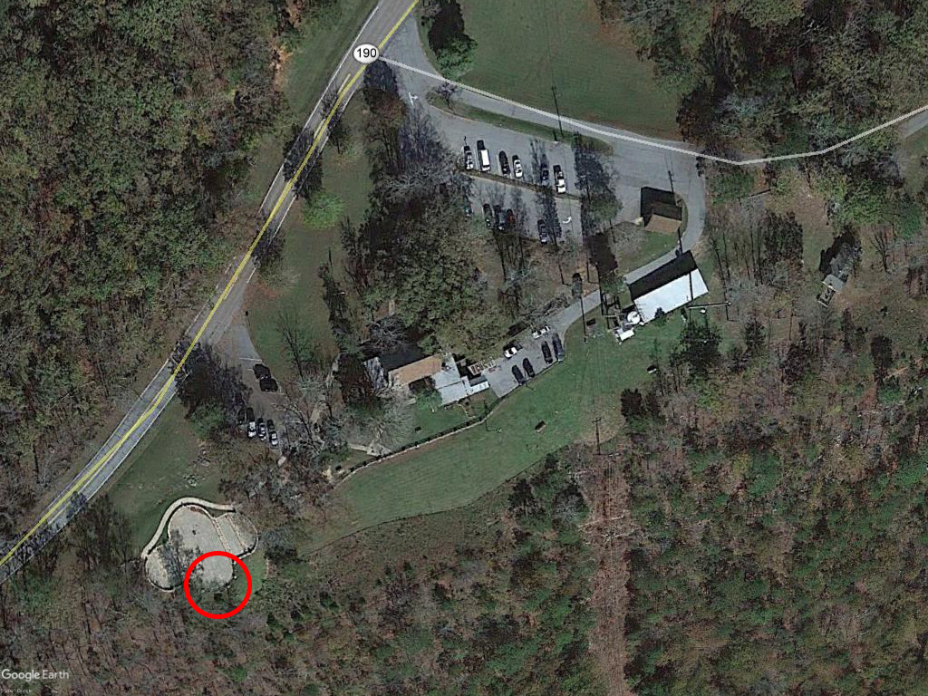
FDR State Park Office (32° 50′ 13.6″ N, 84° 48′ 58.7″ W)
Anywhere along the fence line behind the office will provide a good view but only the southern tip of the amphitheater will allow you to see the entry burn as well. Historical note: The office was constructed by the Civilian Conservation Corps in 1938 and originally served as an inn and restaurant.
Overlook #2 (32° 50′ 29.1″ N, 84° 48′ 08.2″ W)
Continuing east on Hwy 190, this is the second southern facing overlook. I would only use this location as a last resort since it offers a very limited view of a launch.
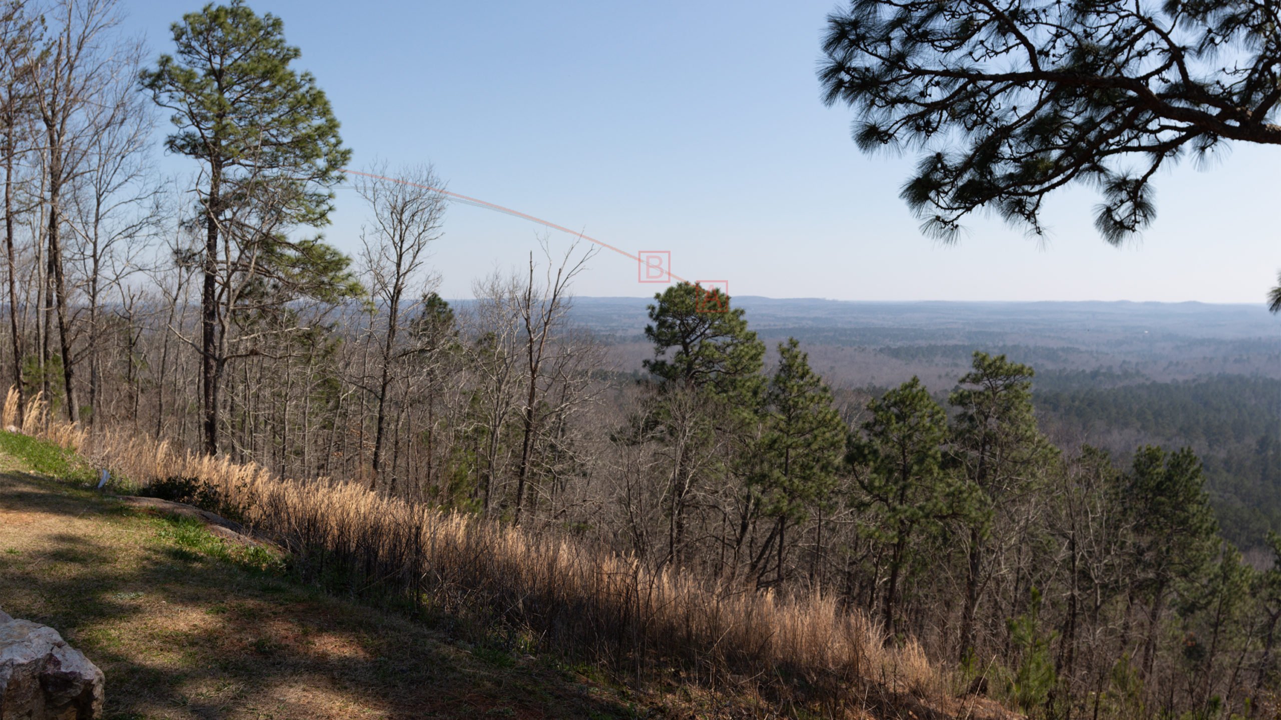
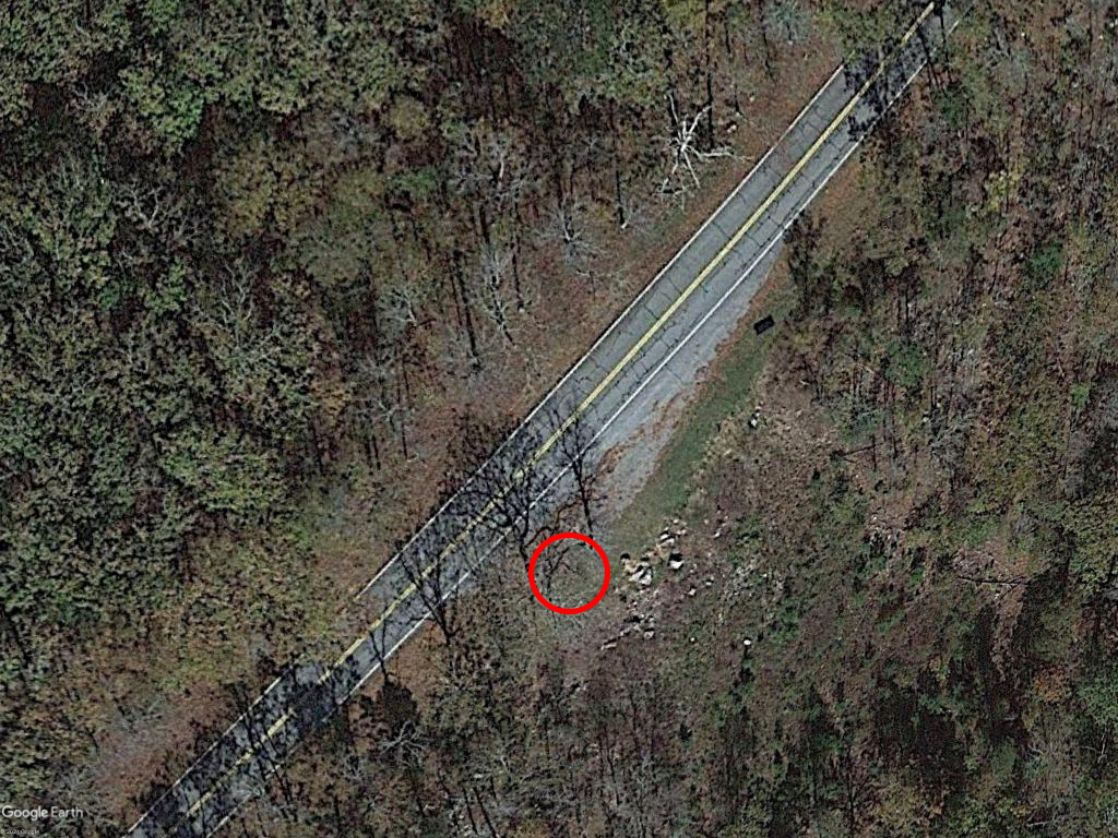
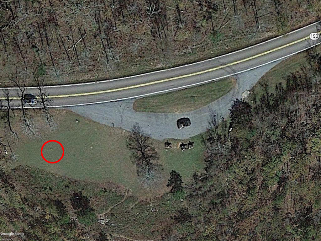
Overlook #3 (32° 50′ 44.6″ N, 84° 46′ 49.5″ W)
This is another location that offers a limited view. This spot is somewhat famous because it was used as a filming location for a KIA Telluride commercial that aired during the 2019 Super Bowl (seen here at the 20 second mark). The tree in the commercial can be seen on the left side of the view below. If you go looking for the city lights in the commercial you won’t find them, they are CGI.
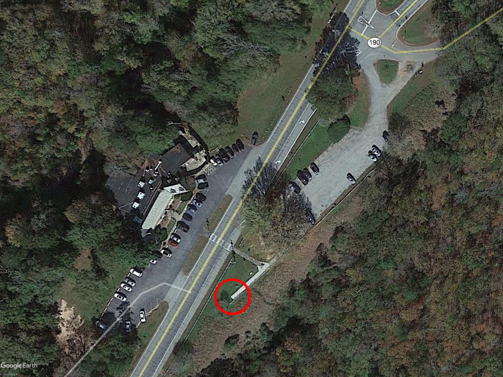
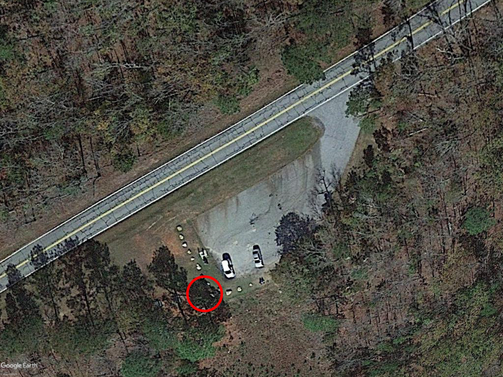
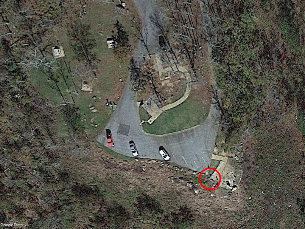
Dowdell’s Knob (32° 50′ 23.3″ N, 84° 44′ 42″ W)
Said to be one of President Franklin D Roosevelt’s favorite spots, this is the best view of any location in Harris County. From here you will be able to see the entry burn for a drone ship landing along with visibility of the second stage all the way to the horizon. However, there is one downside – the gate at the beginning of the access road may be closed and locked during hours of darkness. I recommend arriving at Dowdell’s Knob well before the scheduled liftoff time, that way if the gate is closed you have time to move to another location.
What You Can See
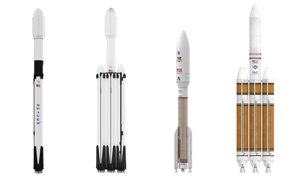
Before I describe the show let me briefly introduce the performers. Currently being launched from Cape Canaveral are, from left to right, the Falcon 9 and Falcon 9 Heavy from SpaceX and the Atlas V and Delta IV Heavy from United Launch Alliance. The Falcon 9 is by far the most frequently launched, averaging 1 per week.
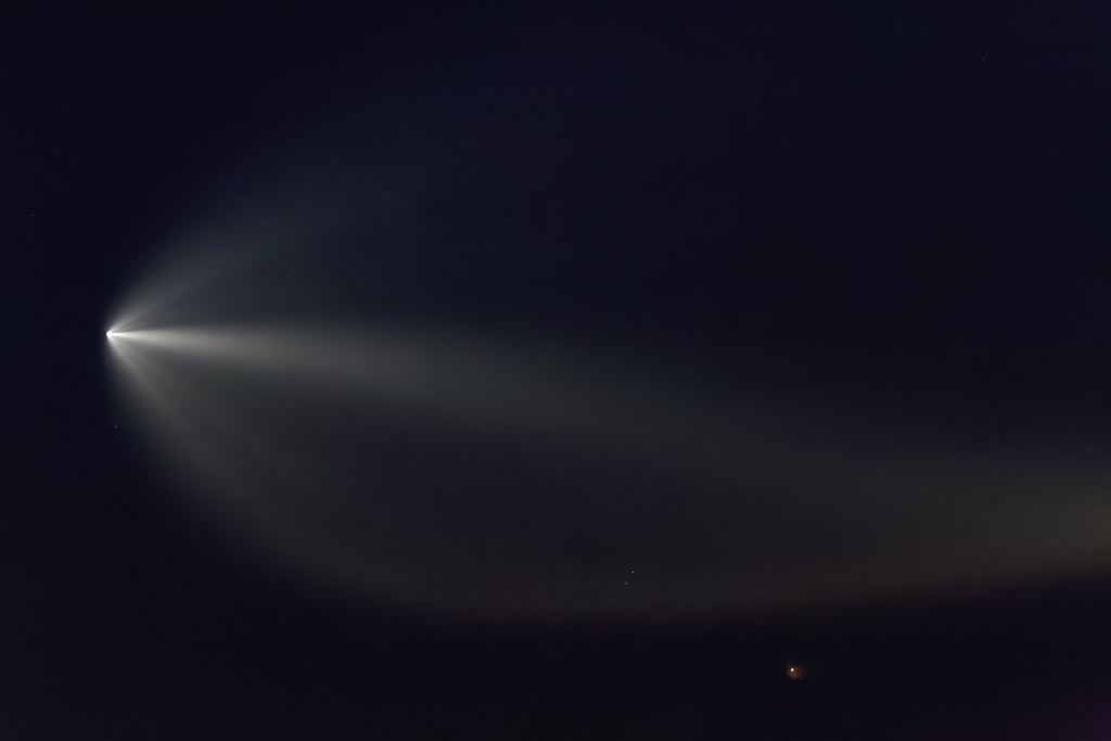
The first view of a rocket occurs 90 to 120 seconds after liftoff when it climbs above the southeastern horizon. Launches that take place 30 to 70 minutes before sunrise are particularly good because they can produce a twilight phenomenon. This occurs when the rocket’s exhaust plume becomes illuminated by sunlight at high altitudes. The effect can also be seen after sunset but it is less pronounced because the rocket is flying away from the sun.
Time-lapse of an Atlas rocket carrying the Boeing Starliner. This was recorded from Dowdell’s Knob on 20 December 2019 at 6:43am (54 minutes before sunrise).
Launches outside of the twilight phenomenon window are not as spectacular. Typically you will see a red flame climbing up from the horizon until MECO (Main Engine Cut Off). The second stage is a dim dot of light which can be difficult to see with the naked eye.
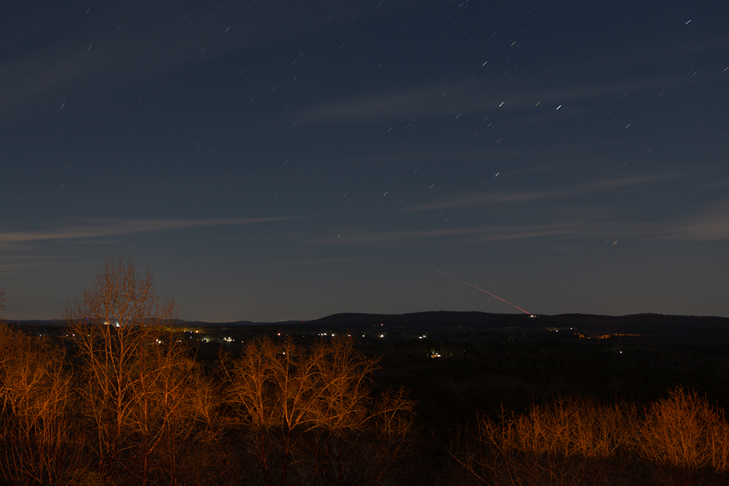
Starlink V1 L27 launch to MECO. This was recorded from Dowdell’s Knob on 9 May 2021 at 2:44am (6 hours 17 minutes after sunset).
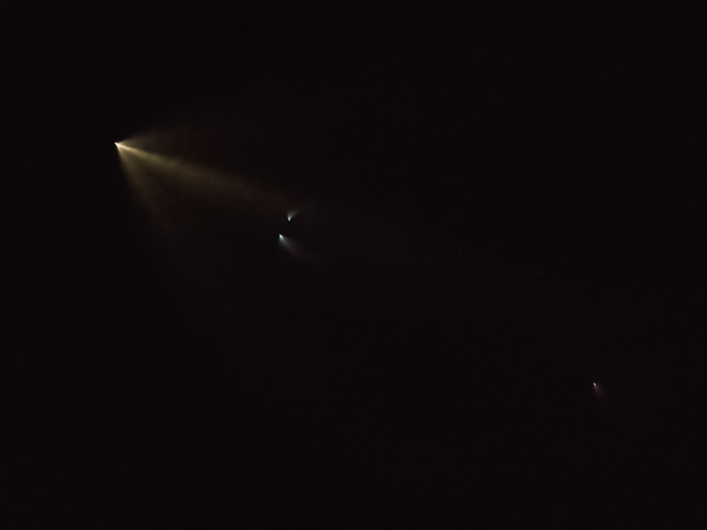
Something else that can be seen is the entry burn for a Falcon 9 booster. Where to look for the burn depends on where it is landing. If it is landing on an ASDS (Autonomous Spaceport Drone Ship) you need to face east and if it is landing at Cape Canaveral you need to face southeast. In either case the burn will occur roughly 6 to 7 minutes after liftoff and will be less than 2° above the horizon.
Drone view of the entry burn from the Starlink V0.9 L0 mission. This was recorded from Cataula on 24 May 2019 at 10:32pm (1 hour 55 minutes after sunset).
Entry burn from the Starlink V1 L27 mission. This was recorded from Dowdell’s Knob on 9 May 2021 at 02:48am.
It is also possible to see a rocket transit across the rising sun or moon. This is not something that can be seen with the naked eye so you will need some form of optical aid like binoculars, a telephoto lens, or a telescope. WARNING – even though the sun may be low on the horizon it can still cause serious eye injury or blindness if you look at it with the naked eye. Do not look at the sun without solar glasses (aka eclipse glasses) and do not attempt to watch a solar transit without having a solar filter attached to the front of your optical aid.
A solar transit of the second stage from the Starlink V1 L13 mission. Note the distinctive < shaped plume. This was recorded from a very windy FDR State Park office on 18 October 2020 at 8:30am.
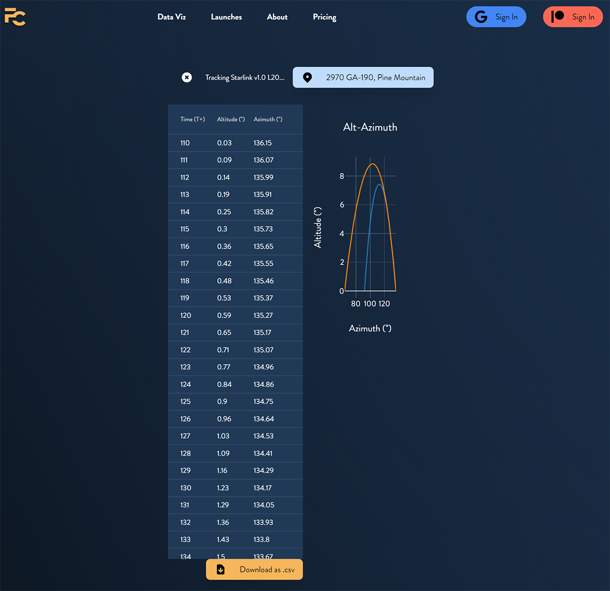
If you want exact directions where to look, visit the Flight Club website. From the top of the homepage select Data Viz, then select the Alt-Az Generator. On the next page enter your location, then enter and select the mission name. This will generate a table that shows the altitude and azimuth of the rocket for every second it is visible.
When Is The Next Launch?
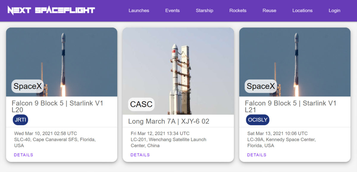
A schedule of rocket launches can be found at the Next Spaceflight website along with the corresponding app for Apple and Google devices. If you use the website you need to convert the time from UTC to Eastern (subtract five hours for Standard Time or four hours for Daylight Savings Time). If you use the app the time conversion is done automatically.
On launch day you can follow the progress of the countdown with the following links:
NASA (missions to the ISS): Twitter, Youtube
SpaceX: Twitter, Youtube
United Launch Alliance: Twitter, Youtube
Patience, Patience, Patience
There are many variables that need to be just right in order to see a rocket launch. First and foremost, the sky needs to be clear all the way to the horizon. Even if the sky is clear at your location the weather at Cape Canaveral or the drone ship landing zone could prevent a launch. Everything has to be electronically and mechanically sound with the rocket and its ground support equipment. There is also the possibility that a catastrophic failure could prevent the rocket from climbing above the horizon. The point here is do not be disappointed if the rocket does not appear. I have been ready to photograph several launches only to have an abort occur within the final two minutes of the countdown. With launches from Cape Canaveral occurring at the rate of 1 per week there will be other opportunities should an abort occur.
Of course…
There’s nothing like taking a seven hour trip to Cape Canaveral to witness a launch up close. I have been lucky to witness three out of four launches (two launched on time, one was delayed four days, and another had an extended delay that exceeded my vacation time). If you decide to go you definitely need to plan for delays.
Headphone usage highly encouraged for these videos
During a clear sky morning launch of an Space-X rocket, for the average unaided human eye, what roughly is the average maximum altitude one can see the rockets exhaust plume?
For launches up the east coast (i.e. missions to the ISS) the booster exhaust plume is visible up until stage separation which takes place around 5-6° above the horizon. After that the broader second stage plume reaches around 10° before it starts descending over the horizon.