
Twice a day, at 11:00 and 23:00 UTC, the National Weather Service launches weather balloons from 69 locations in the contiguous United States. Hanging below the balloon is an instrument package called a radiosonde that transmits weather data every second during the flight. This weather data includes pressure, temperature, relative humidity and GPS position. This data is then added to computer models which give meteorologists the information they need to issue forecasts.
Tory Carissimo from Overlook Horizon has a video that describes in detail how to track these weather balloons. Rather than rehash the excellent information he provides, I’ll let him explain the process. After the video I’ll describe how to track weather balloons from Harris County.
Equipment
The tracking equipment mentioned in the video is available exclusively from Amazon. The Nooelec GOES bundle includes the parabolic dish, software defined radio, low noise amplifier, and all the cabling needed to hook it up to a computer. And yes, this same equipment can be used to receive images from the GOES weather satellites.

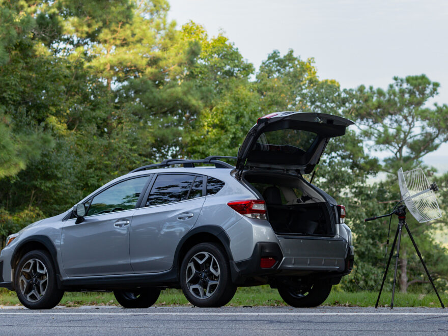
To track the balloon I use a Manfrotto 502 Fluid Video Head attached to a tripod. Attached to the head’s quick release plate is an ADM D-Series Dovetail Adapter which connects the L-bracket on the parabolic dish with the video head. This makes the system very easy to transport and set up.

Launch Sites & Radiosonde Frequency
The closest upper air observation site to Harris County is the NWS Peachtree City office at the Atlanta Regional Airport-Falcon Field (KFFC). So far all of the balloons I have tracked from FFC have used the frequency of 1676 MHz.

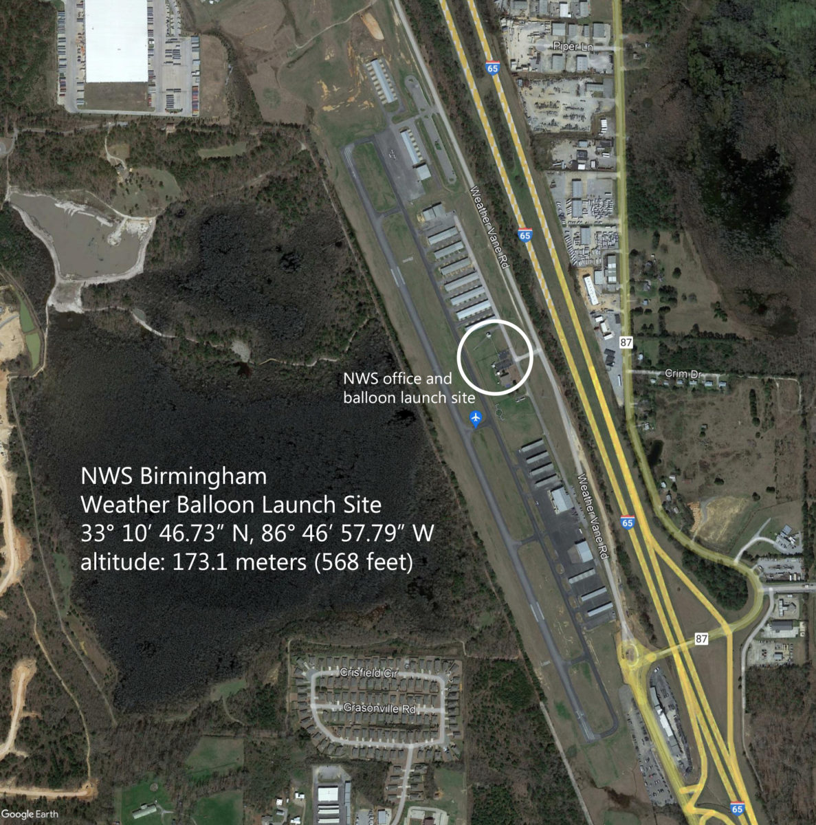
Balloons from the NWS Birmingham office at the Shelby County Airport (KEET) can also be tracked from Harris County. NWS Birmingham uses the 1676 MHz frequency.
Balloon Flight Prediction
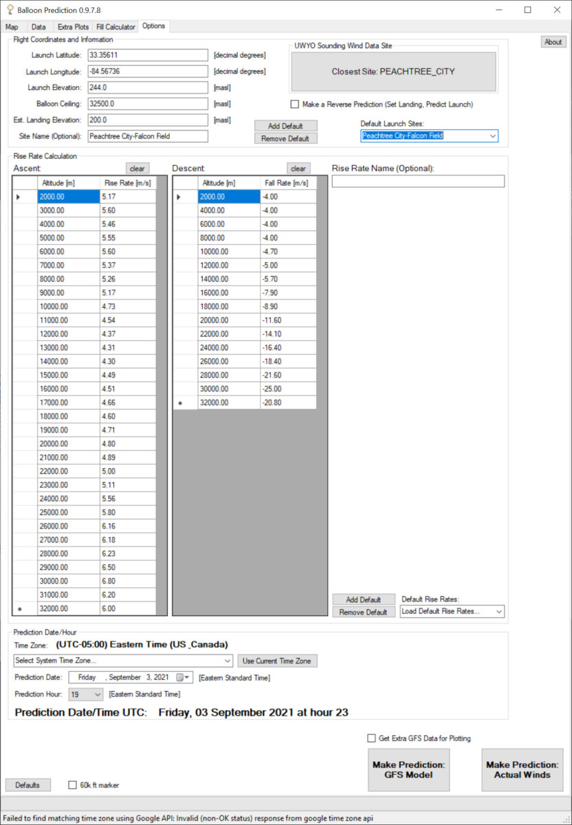
In addition to the Habhub Landing Predictor mentioned in the video, I also use Balloon Prediction from NOAA. This software allows you to further refine a prediction by:
- saving and choosing from multiple launch sites
- choosing wind data from specific sites
- assigning ascent and descent rates for various altitudes
- reverse prediction (known landing site, predict the launch site)
- making a prediction based upon GFS model or actual winds (uses data from the most recent balloon flight)
Tracking Location
The video mentions it is best to track the balloon from a high location. In Harris County that means the Pine Mountain ridgeline. Using the overlooks along Hwy 190 in FDR State Park I have been able to track balloons from over 100,000 feet down to less than a hundred feet above the ground. These elevated overlooks will allow you to obtain a very precise landing location.
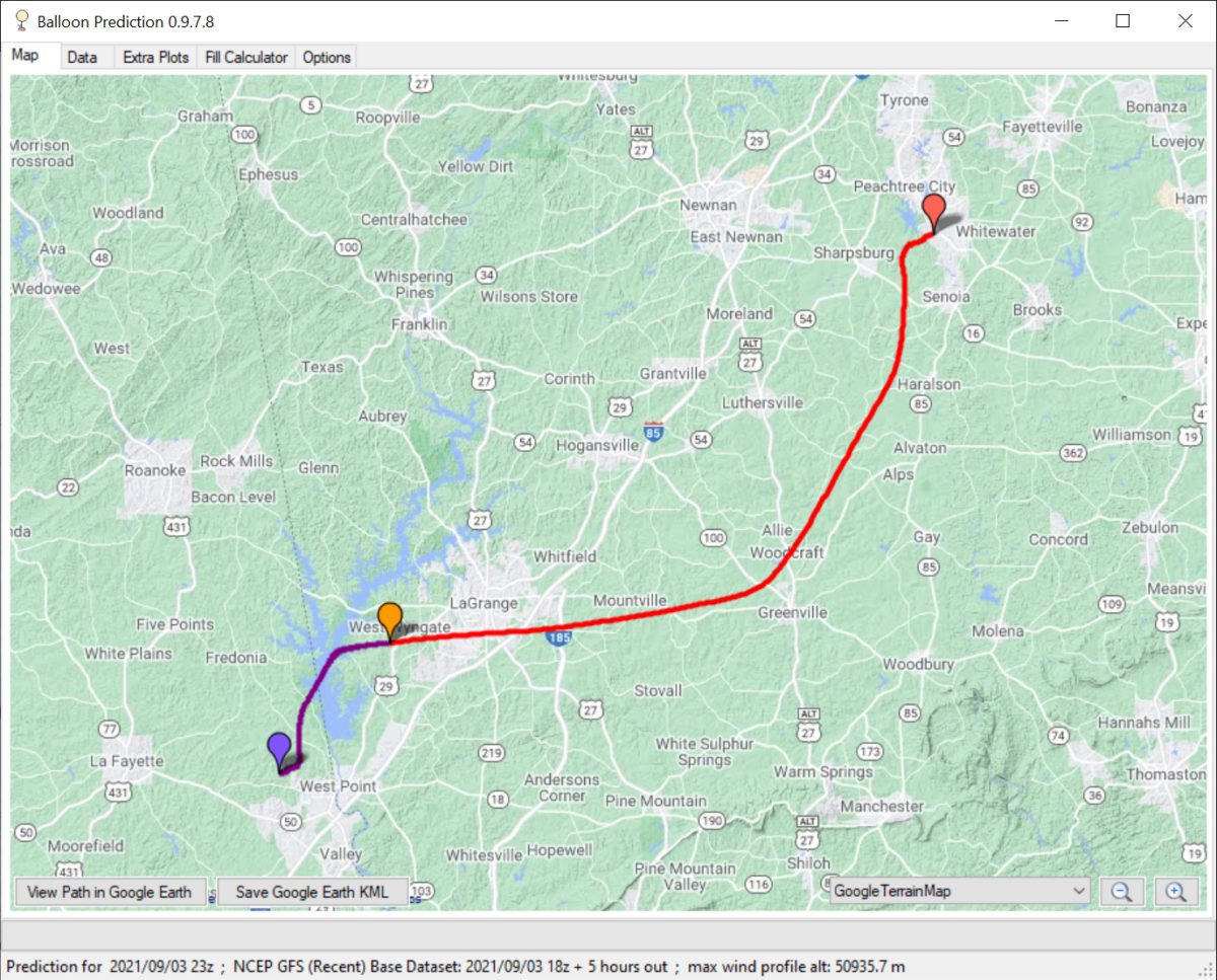
Here are some examples from recent tracks.
Friday evening, 3 September
This was my first attempt to track from the Pine Mountain ridgeline. The predicted landing site was near Country Club Rd in West Point.
I was able to track the radiosonde down to 224 meters ASL (about 116 feet above ground) at a distance of 24.6 miles. Using the last direction and horizontal velocity I came up with an estimated landing location 3.3 miles southwest of Huguley, Alabama.

The next day I traveled to that location and using a drone I was able to locate the parachute exactly where I estimated it would be. Unfortunately this location is on private property and I have not been able to identify who the land owner is to ask for permission to recover the radiosonde.
Saturday morning, 4 September
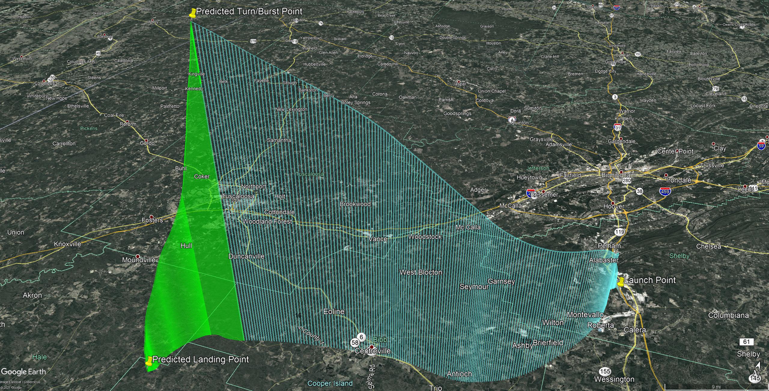
This track had me scratching my head. It was predicted to land northwest of West Point. As the radiosonde was descending through 10,602 meters (34,783 feet) the signal strength suddenly dropped by two-thirds and I lost telemetry even though I could still hear the signal. It took me about 30 seconds to reacquire telemetry because the elevation of the radiosonde was now much lower than before. I immediately noticed something strange, even though the elevation was lower the radiosonde had climbed to an altitude of 15,156 meters (49,724 feet) and was in the western half of Alabama! I kept tracking until it disappeared below the horizon at an altitude of 9,854 meters (32,329 feet).
Sonde tracking map
I did not figure out what happened until I got home and reviewed the log. When I lost telemetry the radiosonde ID was 1517 but when I reacquired it was 1c48. In an incredible stroke of luck I had lost the NWS Peachtree City radiosonde and acquired the NWS Birmingham radiosonde.
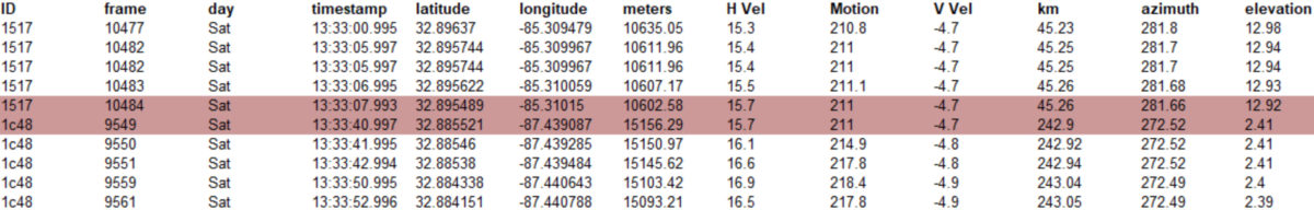
So what happened to the NWS Peachtree City radiosonde? I’m guessing there was a battery or electronic failure that instantly stopped the signal transmission.
Saturday evening, 4 September
This was another track from the first overlook east of the Country Store. The predicted landing site was northwest of LaGrange. I was able to track it all the way down to 45 feet above the southern end of Willow Crest Lake at a distance of 21.2 miles. Given the location I did not attempt to recover. The video lets you see what happens to the radiosonde signal when it nears the horizon.

One comment
Comments are closed.