On the evening of July 21 a thunderstorm traversed Harris County from northwest to southeast. The storm was displaying an impressive amount of lightning on the My Lightning Tracker app so I launched the drone around 6:48pm. By then the cell had reached I-85, about 13 miles away.
Storm track from MyRadar
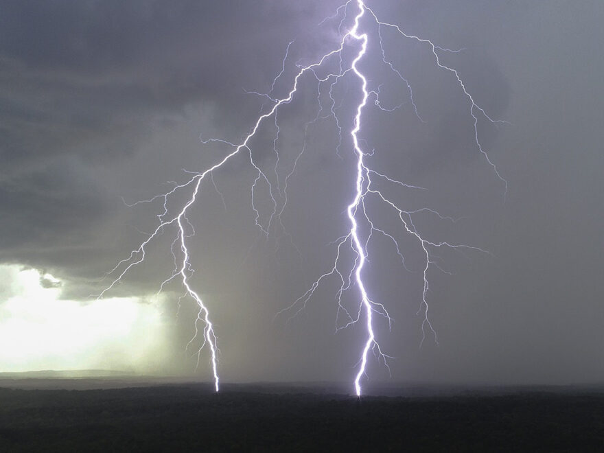
Initially the strikes were not that great. But as the cell continued southeast and neared Hamilton some impressive bolts began to appear shortly after 7:00pm.


When I relaunched the drone after a battery swap around 7:10pm the bolts were flying fast and furious. Around 7:14pm I noticed a second rain shaft had developed to the west which I started keeping an eye on. Then at 7:21pm NWS Atlanta issued a Severe Thunderstorm Warning.
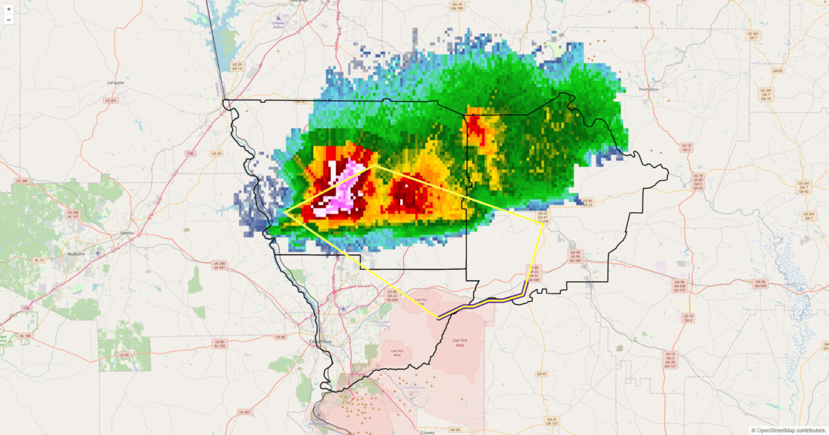
BULLETIN - IMMEDIATE BROADCAST REQUESTED
Severe Thunderstorm Warning
National Weather Service Peachtree City GA
721 PM EDT Fri Jul 21 2023

The National Weather Service in Peachtree City has issued a

Severe Thunderstorm Warning for…
Northeastern Muscogee County in west central Georgia…
Southwestern Talbot County in west central Georgia…
Southeastern Harris County in west central Georgia…

Until 800 PM EDT.

At 720 PM EDT, a severe thunderstorm was located near Mulberry
Grove, or near Hamilton, moving southeast at 25 mph. HAZARD…60 mph wind gusts and quarter size hail. SOURCE…Radar indicated. IMPACT…Hail damage to vehicles is expected. Expect wind damage
to roofs, siding, and trees.

Locations impacted include…
Hamilton, Waverly Hall, Upatoi, Ellerslie, Box Springs, Midland,
Cataula, Baughville, Fortson, Mulberry Grove and Olive Branch.

PRECAUTIONARY/PREPAREDNESS ACTIONS…

For your protection move to an interior room on the lowest floor of a
building.

If you see wind damage…hail or flooding…wait until the storm has
passed…and then call the National Weather Service toll free
at 1 8 6 6 7 6 3 4 4 6 6 or tweet us your report at NWSATLANTA.

&&

LAT…LON 3268 8506 3276 8488 3266 8454 3254 8458
3253 8462 3253 8465 3252 8468 3252 8470
3250 8475
TIME…MOT…LOC 2320Z 296DEG 21KT 3269 8493

HAIL THREAT…RADAR INDICATED
MAX HAIL SIZE…1.00 IN
WIND THREAT…RADAR INDICATED
MAX WIND GUST...60 MPH
I continued to record the lightning near Hamilton until I heard a loud crack of thunder to my west. Panning in that direction I was dazzled by a bolt that struck less than one mile away. I took that as my cue to land post haste. During the descent two more bolts struck within two miles.


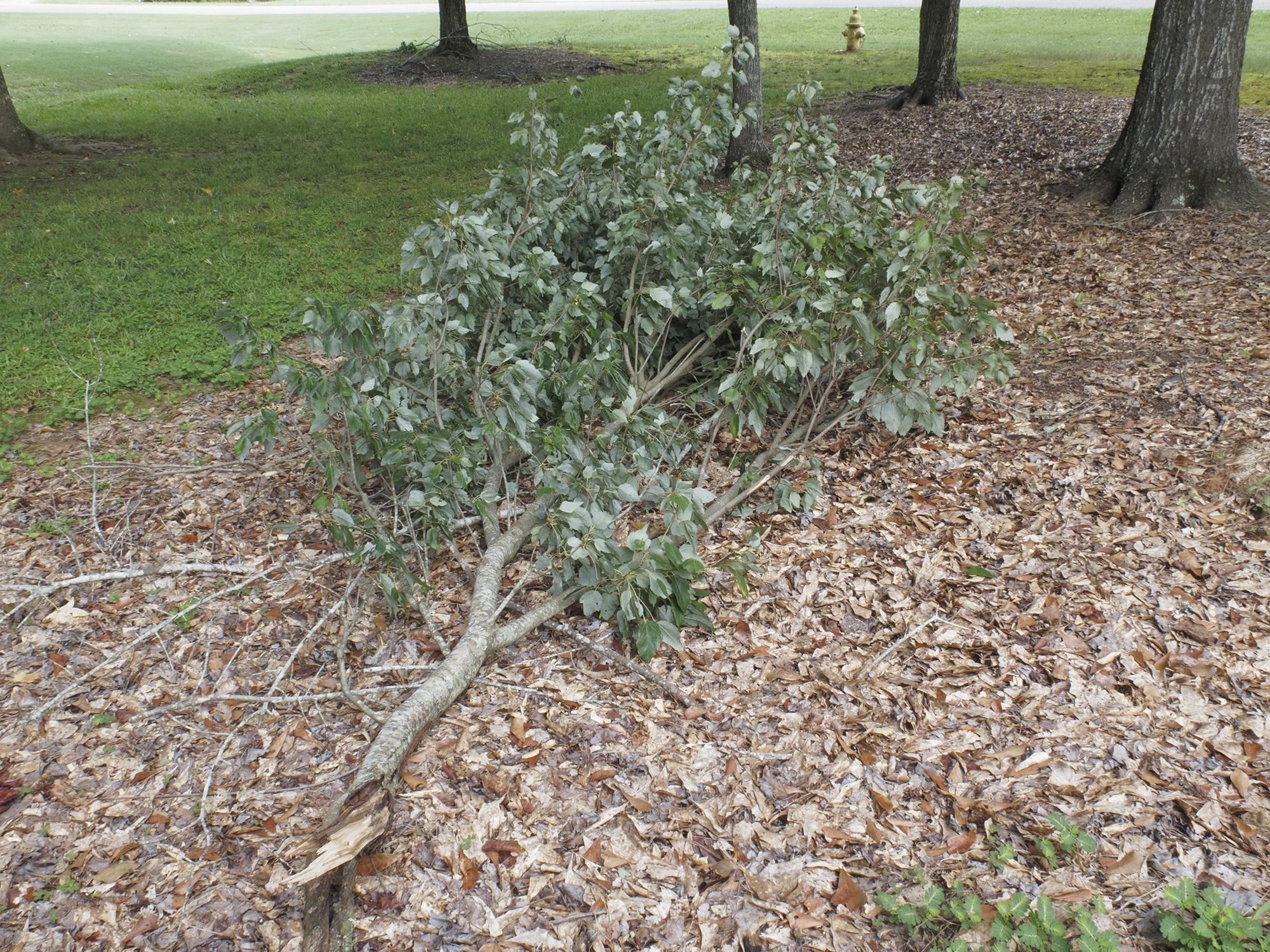
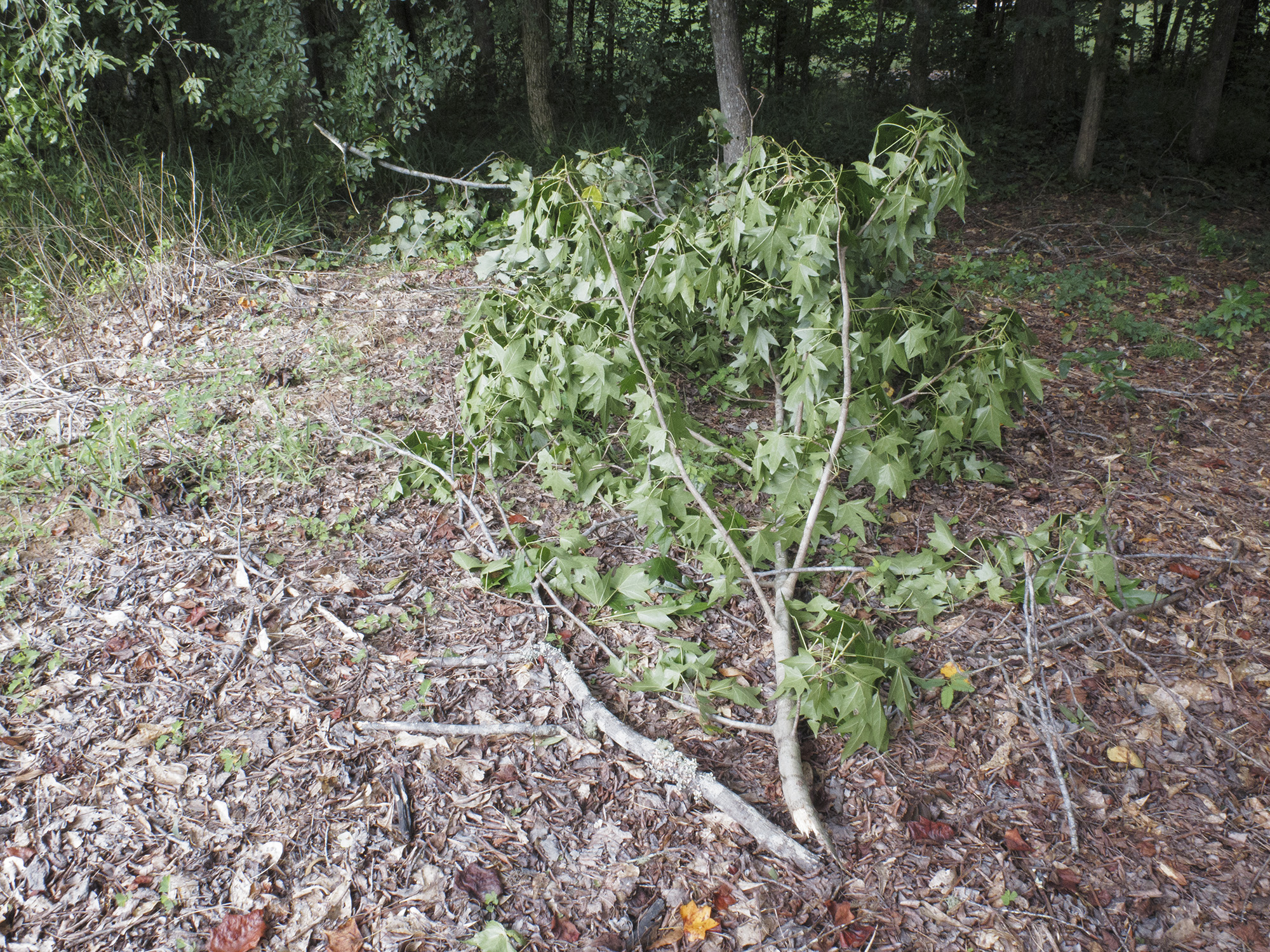
About five minutes after landing the severe thunderstorm hit my location with estimated 50-60mph wind gusts which resulted in a some 2-3 inch diamater limbs getting ripped off trees. No hail was observed.